

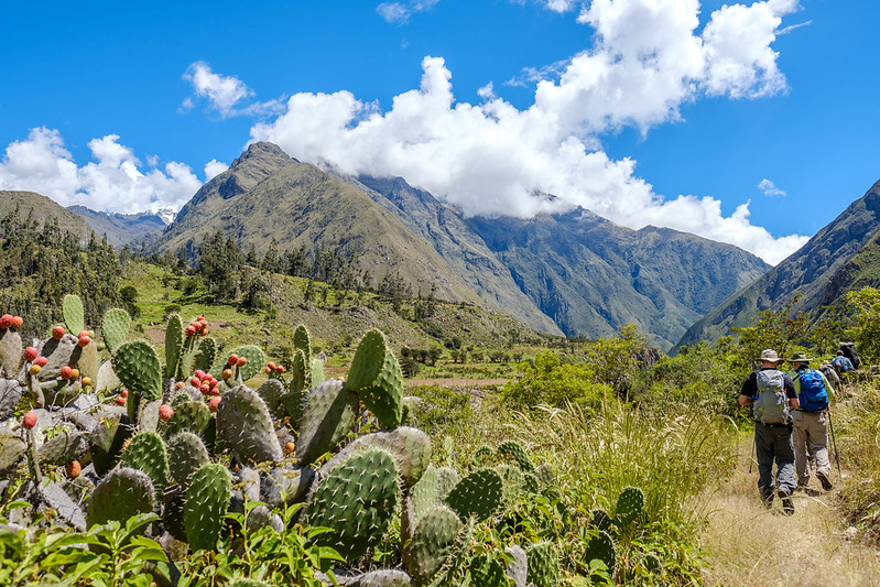
This archaeological complex and Inca town is the first to be observed on the 4-day Inca trail. It is a citadel built almost on the banks of the sacred river of the Incas (Vilcanota river), currently known as the Urubamba river. This urban location is located in a strategic area where two rivers and a series of Inca trails converge, leading to many other urban centers such as Machu Picchu, Chachabamba, Wiñawayna, Wayllabamba, Paucarcancha and others.

Llactapata or Qentepata
Summary
Where is Llactapata located?
This urban center of the Incas is located 3 kilometers from the famous km 82, where the first official control of the famous classic Inca trail to Machu Picchu is located. It is located at an altitude of 2745 meters, between the Vilcanota and Wayllabamba rivers. Llactapata is still within the famous Sacred Valley of the Incas.
How’s the weather?
The sacred valley is known for having a temperate climate that is very comfortable for humans. Llactapata, and its surroundings have a temperature between 18 and 22 degrees Celsius during the day and drops to approximately 11 degrees at night.
What products are grown in Llactapata?
Studies of pollen in the soil of the archaeological complex and the climatic conditions of the place, indicate that the Incas 500 years ago planted mostly corn and to a lesser extent other vegetables such as pumpkins and tomatoes.
Currently, in this part of the Inca trail, 80% corn is cultivated and the remaining 20% is divided between potatoes, pumpkins, aromatic herbs and a shrub called Tara.
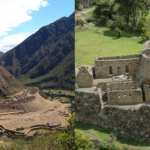
View around Llactapata
What was the purpose of Llactapata in Inca times.
This geographical place was already inhabited since before the arrival of the Incas, the first inhabitants to leave archaeological and architectural evidence were the Ayarmaca, who inhabited this area between 800 and 1100 after Christ. Later they were violently conquered by the Incas, who built Llactapata on the foundations of an older Ayarmaca town. We know that these first inhabitants were violently conquered by the countless skeletons found with fractures caused by combat objects.
This very famous Inca site on the Inca trail is located in a strategic area of agricultural control and a network of Inca trails that lead to many Inca towns.
It has cultivation terraces, houses, housing for visitors, squares, places to store food products and sacred places.
Analyzing various factors, we can conclude that Llactapata in Inca times was a town with administrative, economic, social and military functions that controlled the new annexed towns of that region and agricultural production.


Leave A Reply